

The Dennis Creek Trail leads you up to a spectacular vista of alpine peaks and wildflowers! The trail itself is short, but the options for further ridge-line wandering and exploration are endless!
SUMMARY
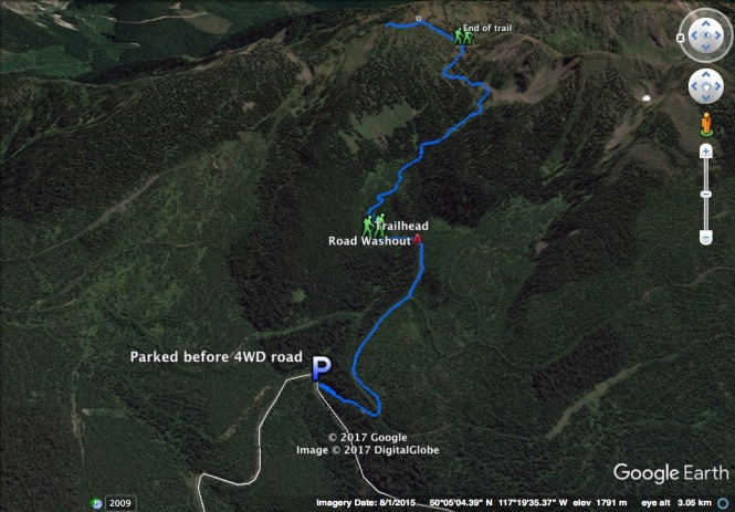
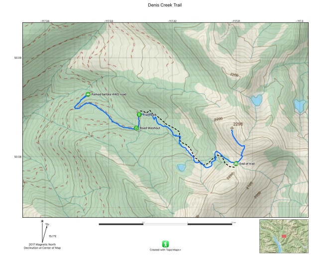
Trailhead: 10km up Hicks Creek Road
Distance, Round Trip: 3.6km
Elevation: +360m
Trailhead
The Dennis Creek Trailhead is located halfway along the access road to Alps Alturas. Driving directions can be found at Sites and Trails BC.
The last 1km of the access road is very rough, so you may want to park at the junction. We started up the last 1km and encountered mud, a deep puddle, and then some very rough rocks and thought “nope!” and backed down despite being in 4WD. If you do attempt the road, know that there is an impassable washout about 800m up so you won’t get to park at the overgrown trailhead anyways.
Parked at the junction like us? Add another 2.5km round trip and +122m elevation to the day’s tally!


Up to the saddle
The actual walk to the saddle of the ridge is short, steep, and specular. The trail winds up through an old cutblock, taking you across streams and meadows and a newly growing forest. Chances are there won’t be many (if any) other hikers on the trail, so making frequent bear calls is a good idea as this is prime grizzly habitat.


Looking ahead, the trail bends towards a low point on the ridge line, bringing you gently up to a saddle after 1.8km from the trailhead.

Final ascent to the saddle
End of the trail
The official trail ends at the top of the saddle overlooking Dennis Creek Basin, and that’s okay because it’s choose-your-own-adventure on the ridge!
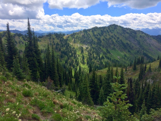
Looking out from the saddle onto Dennis Creek Basin
Heading right (south), there is a very faint trail winding up some smaller peaks. This is probably an easier option for folks who don’t want a lot of elevation gain and want the confidence of a route.
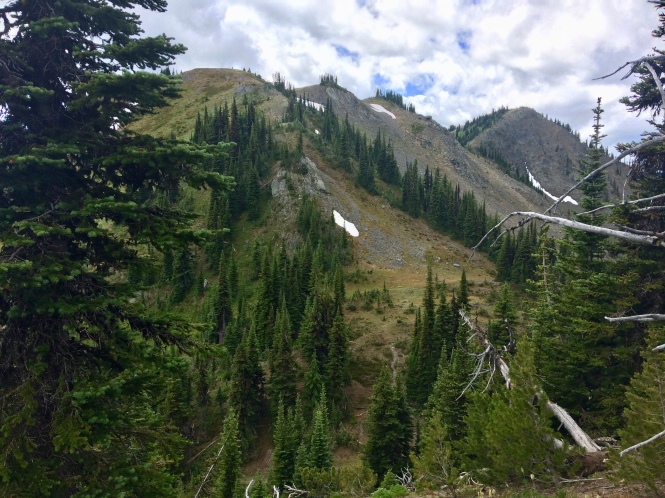
Looking up the ridge to the right
Heading left (north), the ridge line ascends to the summit (unnamed peak of 2298m) and this is by far the more scenic and more challenging route! We went left!
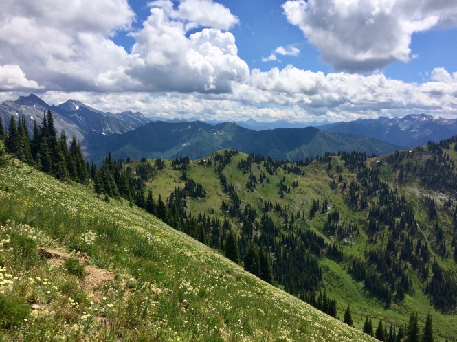
Heading left up the ridge – great flowers!
Up on the ridge top
Trying to find a route to the summit, we found the south-east slope of the ridge had better footing and was more gentle to climb. Once we got to the higher ridge, we could look ahead and see the summit in the distance:

Summit and cairn in the distance
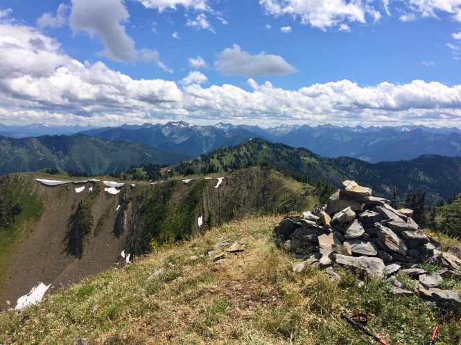
The summit! Looking back at the ridge line
Panorama time
It was lunch-time at the summit! And that also meant time to shuck off the boots and the pack and take a million panoramas!


Ascending to the summit added an additional 1km round trip and +135m elevation. It was well worth the effort!
Although the Dennis Creek Trail is short, there are lots of options to extend the distance with ridge-line exploration! And the trail is in the same area as Alps Alturas and Wilson Creek Falls so it could be a great addition to another trip!
Download KML File – Dennis Creek Trail

[…] but overall the access road was pleasantly tame. Along the way, we passed the access to the Dennis Creek Trail – another […]
LikeLike